Babylonian Map of the World (700-500 BCE)
1 2021-06-21T15:33:49-04:00 Benjamin Steinig 74775bc5c03628537e0192f4b5deec6811d610f6 7 1 This was a unique map of the Mesopotamian world. Babylon is displayed in the center, while Assyria, Elam, and other places are named. While it may look like this map shows the correct positions of these places, this map is today used for an explanation for the ancient Babylonian view of the mythological world. This data visualization can be found at https://www.ancient.eu/image/526/babylonian-map-of-the-world/ plain 2021-06-21T15:33:49-04:00 32.507778, 44.426720 700-500 BCE Benjamin Steinig 74775bc5c03628537e0192f4b5deec6811d610f6Contents of this tag:
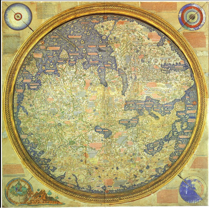
- 1 2021-06-21T15:33:49-04:00 Benjamin Steinig 74775bc5c03628537e0192f4b5deec6811d610f6 Primary Source Data Visualizations for World History and Geography 4 This page provides a list of primary source data visualizations to support inquiry in world history and geography. They are organized according to the periodization scheme in Michigan's social studies standards for world history. plain 2022-01-27T01:59:24-05:00 1150 BCE Tamara Shreiner 72eaa2d1ba1352b75b8a8da73e879a4ceb510ae0