Carte Pisane (1275-1300)
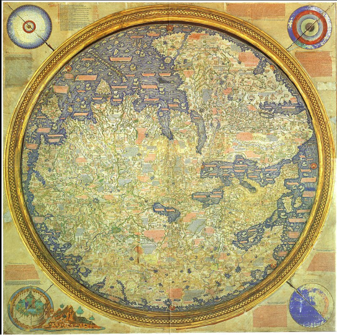
1 2021-06-21T15:33:49-04:00 Benjamin Steinig 74775bc5c03628537e0192f4b5deec6811d610f6 7 1 The Carte Pisane (or Carta Pisana) is the oldest portolan chart (ancient nautical chart). It was probably of Italian origin, created in the second half of the 13th century. Evidence suggests that this chart was originally part of an atlas. Researchers have concluded that this map was not created by a professional clerk or scholar, based on the handwriting on the map. The map shows the entirety of the Mediterranean, the Black sea, and part of the coast of the Atlantic. Most of the accurate aspects of the map is limited to the Mediterranean. plain 2021-06-21T15:33:49-04:00 43.726948, 10.437983 1275-1300 Benjamin Steinig 74775bc5c03628537e0192f4b5deec6811d610f6Contents of this tag:
- 1 2021-06-21T15:33:49-04:00 Benjamin Steinig 74775bc5c03628537e0192f4b5deec6811d610f6 Primary Source Data Visualizations for World History and Geography 4 This page provides a list of primary source data visualizations to support inquiry in world history and geography. They are organized according to the periodization scheme in Michigan's social studies standards for world history. plain 2022-01-27T01:59:24-05:00 1150 BCE Tamara Shreiner 72eaa2d1ba1352b75b8a8da73e879a4ceb510ae0