Kangnido World Map (1402)
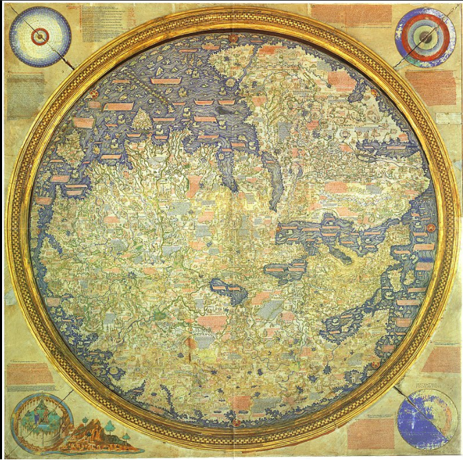
1 2021-06-21T15:33:56-04:00 Benjamin Steinig 74775bc5c03628537e0192f4b5deec6811d610f6 7 1 This is one of the oldest surviving world maps from East Asia and is important in understanding and reconstructing the original form of the 14th century Korean map. This map reflects the Korean and geographic knowledge of China during the Mongol Empire. Islamic geographers provided geographical information about Western countries. This map displays the form of the “Old World”, with Europe and Africa in the East and Japan in the east. There are currently two known copies of the map today, and are located in Japan containing modifications which were added later on. plain 2021-06-21T15:33:56-04:00 37.904830, 127.742408 1402 Benjamin Steinig 74775bc5c03628537e0192f4b5deec6811d610f6Contents of this tag:
- 1 2021-06-21T15:33:49-04:00 Benjamin Steinig 74775bc5c03628537e0192f4b5deec6811d610f6 Primary Source Data Visualizations for World History and Geography 4 This page provides a list of primary source data visualizations to support inquiry in world history and geography. They are organized according to the periodization scheme in Michigan's social studies standards for world history. plain 2022-01-27T01:59:24-05:00 1150 BCE Tamara Shreiner 72eaa2d1ba1352b75b8a8da73e879a4ceb510ae0