Portolan Atlas of the Mediterranean Sea, Western Europe, and the Northwest Coast of Africa (1590)
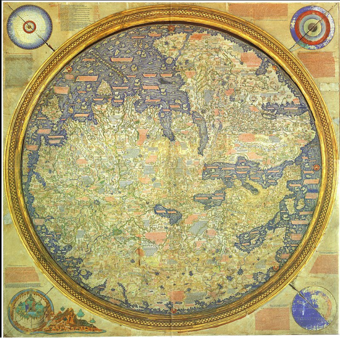
1 2021-06-21T15:33:58-04:00 Benjamin Steinig 74775bc5c03628537e0192f4b5deec6811d610f6 7 1 This map was created by Joan Oliva in 1590. Notice how America and Asia appear to be connected, and the sizes of the continents in the Northern Hemisphere compared to the Southern, plus a lack of Australia and Southern Asia. This data visualization can be found at https://www.loc.gov/resource/g3201pm.gct00065/?sp=5 plain 2021-06-21T15:33:58-04:00 38.270057, 15.548451 1590 Benjamin Steinig 74775bc5c03628537e0192f4b5deec6811d610f6Contents of this tag:
- 1 2021-06-21T15:33:49-04:00 Benjamin Steinig 74775bc5c03628537e0192f4b5deec6811d610f6 Primary Source Data Visualizations for World History and Geography 4 This page provides a list of primary source data visualizations to support inquiry in world history and geography. They are organized according to the periodization scheme in Michigan's social studies standards for world history. plain 2022-01-27T01:59:24-05:00 1150 BCE Tamara Shreiner 72eaa2d1ba1352b75b8a8da73e879a4ceb510ae0